
For those of you that care about such silly things, I thought I’d walk you through my day today. If you are a pilot this isn’t going to be interesting at all, so go surf on YouTube or something.
Saturday and we only had one flight scheduled. The job was picking up personnel that would do maintenance at a telecom site. Pax with internal cargo only. Needless to say they wanted us to be airborne by first light, so we didn’t exactly get to sleep in, not that I am able to anyway.That being said first light today was about 0820 am, so not exactly an early start to begin with.
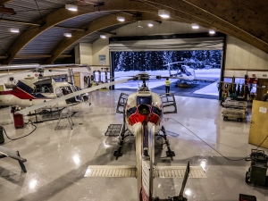
I usually start off by getting my kit ready in the helicopter and browse through the aircraft documentation so that all that remains is a preflight and adding some fuel. This time of year I pack a lot of cold weather gear in case we get stranded somewhere inhospitable. The documentation was fine and no changes to the configuration of the aircraft was required. Typical changes to configuration are the cargo baskets and whether or not the dual-controls should be installed.

Pre-flight planning was next on my list. Checking Notams and weather I quickly realized that the weather could be factor for today’s flight, and snow in particular. Visibility-wise we need at least 800m, which is really quite bad and also impose a speed restriction of 60 kts, meaning we wouldn’t be getting where we were going very fast. The forecast was for visibility down to 300m, which isn’t unusual in showers of snow. My only hope now was that the showers were few and far apart.

Statens Kartverk
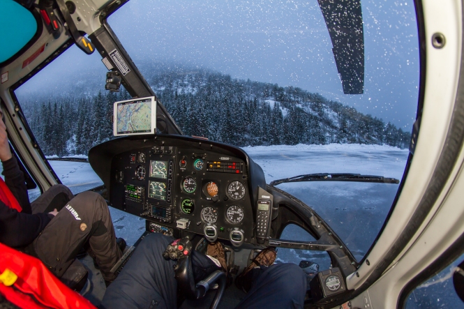
Departure was delayed in order for us to check some webcams enroute when the light was sufficient to make out anything on the cameras. Trip distance was only about 32nm if we’d be able to cross a mountain pass, 50nm if we had to go the long way. In the picture on the right you’ll see a screen capture the map service we use to get obstacle information. This information is also available to us on our iPads, along with our company database that we also share with our competitors. When we are flying our loadmaster use paper maps as our primary means of navigation, but the iPads and GPS’ add good situational awareness for us pilots as well as an added redundancy.
When we were confident that the weather looked ok enroute we called the client who reported good conditions at the landing site. My loadmaster moved the helicopter outside and refueled to allow for some diversions because of the weather. We have a lot of fuel depots in the field, but with weather like today it is hard to rely on getting to any of them in specific.

Preflight inspection, also known as a walk-around. These are done between flights and complement the more thorough daily inspection done prior to the first flight of the day.
As we were getting ready a shower moved in quite quickly. We decided to head back to the office and wait for the shower to pass.
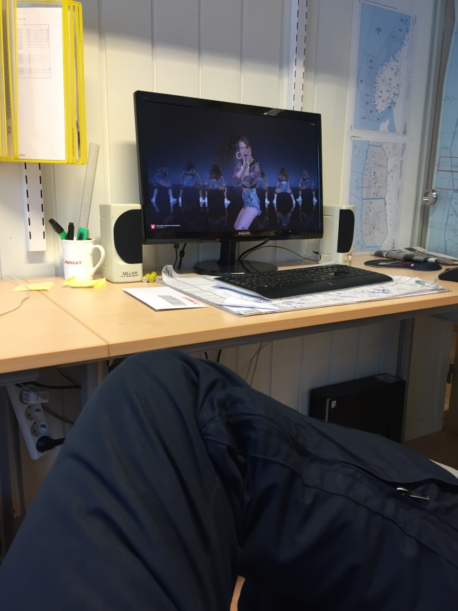
Thinking the shower of snow would pass quite quickly we watched some music videos in an attempt to boost morale. Taylor Swift looks as shocked as I was when I realized there was no end in sight, no pun intended.

After waiting for 3 hours we finally threw in the towel. In the meantime the weather had worsened at the landing site as well, so cancelling the flight wasn’t a tough call to make. The engine is no big fan of snow, so we usually always put on the engine cover to make sure no snow is accumulated on the intake. Attempting to start the helicopter with the cover in place could also be bad news, so I always place the tie-down bag by the cyclic stick when the cover is on to remind me. That being said, if you attempt a start with the cover on you have failed miserably in the preflight check department.
At this time our technical department wanted to do some ground runs to complete scheduled maintenance on one of our helicopters, so it looked like I’d be able to spool up an engine at least. Not exactly flying, but on a day like this I’ll take it.

Shutting down after doing som twist-grip checks for our technical department.

Here is the answer to the question many of you might be asking yourselves. Are these pictures rigged? As you can see in this picture it looks like I am washing a helicopter. Clearly I would never do such a thing, that much is obvious. I think it would be unfair of me to deprive my loadmaster of his work, so the answers is yes, many of these pictures are rigged, this one maybe more than others.
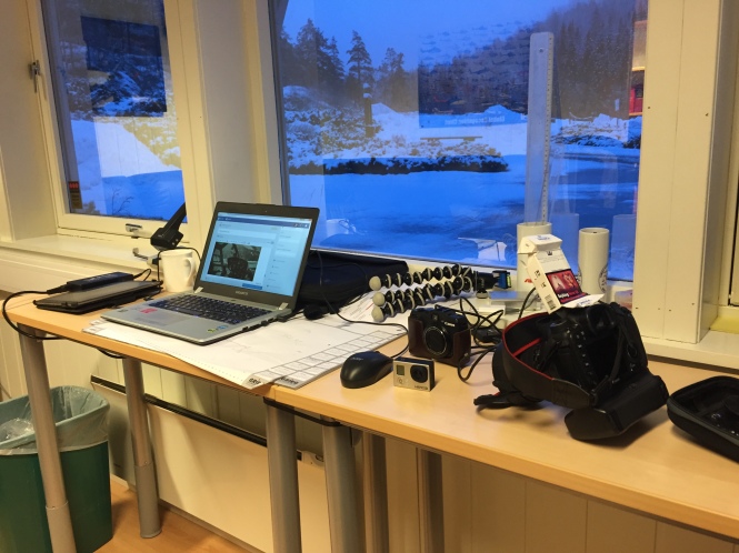
Finally, the picture that sums up what I have spent an unreasonably high amount of time doing today…this blog post.
Today was not unlike many days in this line of work, a lot of work and preparation leading to hours of waiting for the weather to improve. Today it didn’t. If you have any questions please leave a comment.
Have a great weekend!

Nice work Tom, great reading. Reminds me alot of my inland days in Scotland. Good memories and thanks for relighting them for me. Stay safe and keep the blue side up. N:)
LikeLiked by 1 person
Why is your flash covered with a cigarette´s box?. I would like to know more about that technique.
LikeLike
I use that as a flash diffuser on the built-in flash on the camera. Works great. Make sure you use some duct tape or something on the front of the box where the flash is positioned, so that it won’t shine through it directly. You’ll get a subtle difference if the lid is open or closed.
LikeLike
Thanks for the reply Tom. I like your blog by the way.
LikeLiked by 1 person
Thanks, much appreciated! It is a bit thin now, but I hope it can grow into something useful.
LikeLike
I’m a student pilot and I really enjoy reading posts like this, it gives you an idea of what life is like on the other (paid) side of flying 🙂 Keep it up!
LikeLiked by 1 person
Thanks! Glad to hear!
LikeLike